Cocoa-Rockledge: two cities, one school district, shared identity, contested boundary
Cocoa was chartered on October 1, 1895, four years after Rockledge. The two cities share a boundary, a school district, and a roughly continuous urban fabric. Here's how they stayed politically separate while functionally merging.

Cocoa and Rockledge are two separate Florida municipalities that share a boundary, a school district, a hospital system, a chamber of commerce, and a continuous urban fabric you can drive across without noticing. Cocoa was chartered on October 1, 1895, eight years after Rockledge. The two cities have grown into each other without ever merging, defended their separate identities consistently, and benefited and suffered from the arrangement in roughly equal measure.
Origin and order
Rockledge incorporated August 7, 1887 under Florida Acts of 1887 Chapter 3743. Cocoa was chartered on October 1, 1895. Both cities trace their origins to the 1860s and 1870s as Indian River homesteading settlements, distinct from the start because of different landings on the river (Rockledge above the coquina bluff, Cocoa half a mile north at a lower river bank) and different commercial nuclei.
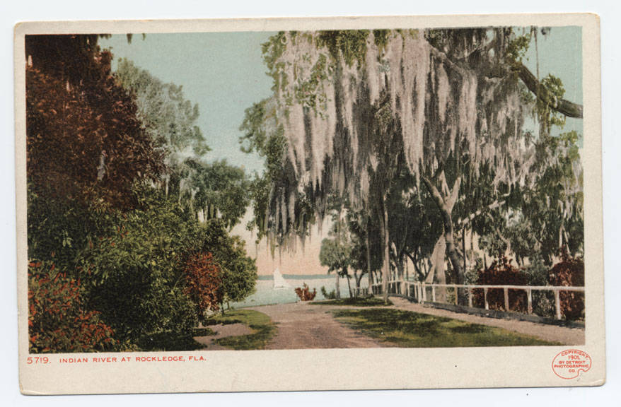
The 1880s-1900s development pattern was the inverse of what came later. In that era, Rockledge was the bigger destination because of the Hotel Indian River and the Gilded Age winter tourism. Cocoa was the citrus-packing and merchant center. Cocoa had the train station for both cities until Rockledge got its own depot in 1893. The two cities served complementary functions.
The 20th-century reversal
Through the 20th century, Cocoa’s commercial role grew while Rockledge’s tourism role declined. Cocoa got the major commercial corridor (King Street, now eclipsed by the more inland U.S. 1 commercial strip), the federally-designated U.S. Highway 1 routing, and the higher-density development along the river that became Cocoa Village. Cocoa Beach, incorporated in 1925 as a separate city across the river, drew the post-war beach tourism market that might otherwise have flowed to Rockledge.
By 1960, Cocoa’s population substantially exceeded Rockledge’s. The Cocoa-Rockledge area’s combined growth was driven by NASA-era employment at Cape Canaveral and Kennedy Space Center; both cities benefited but Cocoa, with more developable land and a better commercial base, captured more of the post-war suburban expansion.
The shared school district
Brevard County has operated a single countywide public school district since the early 20th century. Cocoa and Rockledge students attend the same district. Cocoa-Rockledge High School (now just Cocoa High School) served both cities until Rockledge High School opened in 1968. The two cities still share elementary and middle-school feeder patterns that cross municipal boundaries depending on where students live.
The shared hospital
Wuesthoff Hospital (now Rockledge Regional Medical Center) opened in Rockledge in 1941 and has served both cities continuously. Cocoa never had its own general hospital; Cocoa residents went to Wuesthoff. The 2002 opening of a second Wuesthoff campus at Viera, west of both Cocoa and Rockledge, broadened the service area without changing the Cocoa-Rockledge dependence on Wuesthoff for inpatient care.
The Cocoa-Rockledge Area Chamber of Commerce
A single chamber of commerce serves both cities under the name “Cocoa Beach Regional” (formerly “Cocoa-Rockledge Area Chamber of Commerce” through the 1990s before various rebrandings). The shared chamber reflects the practical economic geography: businesses serve customers in both cities, employees commute across the line in both directions, and zoning and traffic decisions made by one city affect the other.
Annexation pressures
Both cities have annexed unincorporated Brevard County land over the decades. The annexations have generally avoided the shared boundary, working outward (Cocoa to the west and northwest, Rockledge to the west and south) rather than competing for the same parcels. The Viera planned community on the western edge of Rockledge was annexed into Rockledge (with some portions remaining unincorporated) rather than into Cocoa, in part because Rockledge moved earlier and in part because the development site was geographically closer to Rockledge.
There have been disputes. Several parcels along the shared boundary have been annexation-contested. The cities have generally resolved these through inter-local agreements rather than litigation.
Why no merger
A 1970s study commission examined the potential consolidation of Cocoa and Rockledge into a single city. The commission’s report identified administrative-cost savings and recommended consolidation. Voters in both cities rejected the proposal in separate referenda in 1973.
The reasons for rejection are documented in the period’s political coverage. Both cities had distinct identities tied to their incorporation histories. Property tax rates differed (lower in Rockledge); voters in the lower-tax city had no incentive to merge with the higher-tax city. Local political offices and institutions would be reduced under merger; incumbents and their constituencies opposed. The 1973 referenda effectively ended the merger conversation. Subsequent decades have seen no serious effort to revive it.
What’s at the boundary
The shared boundary runs roughly along Brevard Avenue, with adjustments. On the ground, the boundary is invisible. A driver crossing from Cocoa into Rockledge on U.S. 1 sees only a small “Welcome to Rockledge” sign. The architecture, commercial mix, and residential patterns transition without obvious break.
The most visible institutional marker of the boundary is the difference in police uniforms, fire department vehicles, and city signage. Each city maintains its own police force, fire department, public works, parks system, and city council.
What this arrangement produces
Two cities that are functionally one urban area but governmentally distinct. Slightly redundant administrative overhead (two city halls, two police chiefs, two fire chiefs). Slightly competitive economic development (each city pursues businesses for its tax base). Largely cooperative public-service provision (shared school district, shared hospital, shared chamber, shared regional planning). The arrangement is stable. It’s been the operational reality for over 130 years.
What’s different about each city
Rockledge has the Gilded Age residential historic district, the older incorporation date, the lower property tax rate, and (currently) the larger share of the Viera planned community. Cocoa has the larger downtown commercial district (Cocoa Village), the larger overall population, the riverfront tourism (Cocoa Riverfront Park, Pelican Beach), and the more diverse housing stock.
Both cities maintain official histories that emphasize their distinct heritages while acknowledging the shared regional context. The next time someone tells you Cocoa and Rockledge are “really the same place,” tell them about the 1973 referendum.
Population trajectories side by side
The federal census tracks the divergence between the two cities through the 20th century. Cocoa recorded 382 residents in 1900 and Rockledge a similar small count. By 1940, Cocoa had grown to 3,098; Rockledge remained closer to 1,500. The NASA-era expansion in the 1950s and 1960s lifted both cities sharply: Cocoa reached 12,294 by 1960 while Rockledge climbed past 1,500 toward its 1970 figure of 10,523. The mid-century divergence reflects Cocoa’s larger pre-existing commercial base and its earlier suburban-platted land supply.
The 21st-century pattern reversed. The Viera annexation gave Rockledge the dominant share of new growth in central Brevard. By 2020, Rockledge had reached 27,678 residents, well above Cocoa’s 19,041. The crossover happened sometime in the 1990s as Viera buildout began transferring population growth from Cocoa’s western edge to Rockledge’s annexation areas. Cocoa’s 2020 boundaries are similar to its 1960 boundaries; Rockledge’s 2020 boundaries are dramatically larger.
The shift hasn’t changed the on-the-ground feel of the two cities. Cocoa Village remains denser and more pedestrian. Rockledge remains more residential and lower-density even with the Viera additions. The shared boundary along Brevard Avenue is still functionally invisible to a driver. What changed is the tax base and the political weight: Rockledge’s expanded footprint gives it more representation in Brevard County’s intergovernmental committees, more annual budget capacity, and a larger voice in regional planning than its historic share.
Further Reading
Sources
- City of Rockledge, “History”, cityofrockledge.org
- City of Cocoa, “History”, cocoafl.gov
- Brevard Public Schools, district information, brevardschools.org
- 1973 consolidation referendum coverage, Florida Today archive
- Brevard County, Florida: An Illustrated History by Jerrell H. Shofner (Donning Company, 1995)
As an Amazon Associate we earn from qualifying purchases.